New data from the Office for National Statistics (ONS) has for the first time revealed the number of coronavirus deaths in the Sale area.
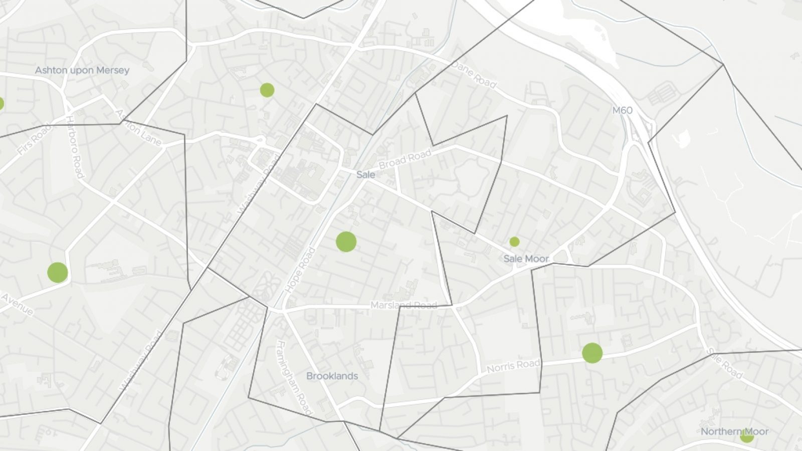
A map, included in the latest Office for National Statistics report, records that between March 1st and April 18th, there have been a total of 17 deaths in the Sale area linked to coronavirus.
The map breaks down the number of COVID-19 deaths by so-called ‘Middle Layer Super Output Areas’ (MSOAs), a size of geographic area used by the ONS.
It reveals there have been the following coronavirus deaths in Sale:
-
- Ashton-on-Mersey – 6
- Sale Centre, Brooklands – 4
- Sale Moor – 5
- North Sale – 2 (either side of Cross Street around Glebelands Road and Dane Road areas)
You can search the map by postcode here:
The figures exclude any deaths of non-residents and cover deaths where coronavirus was the underlying cause or was mentioned on the death certificate as a contributory factor.





![Kevin Matley [image: Facebook]](https://sale.todaynews.co.uk/wp-content/uploads/sites/14/2022/11/Kevin-Matley-facebook-1600x900-1-900x470.jpg)





![Ashfield Road, Sale [image: Google Maps]](https://sale.todaynews.co.uk/wp-content/uploads/sites/14/2022/10/ashfield-road-sale-900x470.png)


![Walton Park war memorial [image: Katy Ratican]](https://sale.todaynews.co.uk/wp-content/uploads/sites/14/2022/10/war-memorial-1600x900-1-900x470.jpg)
![Sale Waterside [image: Katy Ratican]](https://sale.todaynews.co.uk/wp-content/uploads/sites/14/2022/10/waterside-1600x900-1-900x470.jpg)